Atlas and Catalog of Dark Clouds
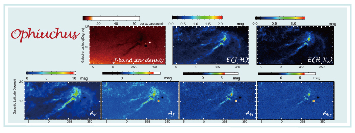
Noise maps, resolution maps, and a catalog of 7614 dark clouds identified using the color excess and extinction maps are also available in the website.The maps derived from 2MASS mainly trace relatively dense regions in dark clouds revealing a number of dense cloud cores leading to star formation, while the Extinction map from DSS is more suited to trace less dense regions and to reveal the global extents of dark clouds. These two datasets are complementary, and all together, they are useful to picture the structures of dark clouds in various density ranges.
Ophiuchus Region